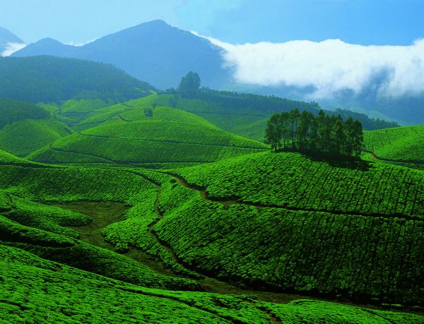
Hill station of Kerala, Munnar. Tea plantations in Munnar

Hill station of Kerala – Munnar
Munnar is a town and hill station located in the Idukki district of the southwestern Indian state of Kerala. Munnar is situated at around 1,600 metres (5,200 ft) above sea level, in the Western Ghats range of mountains, the reason why Kerala is so green.
The name Munnar is believed to mean three rivers, referring to its location at the confluence of the Mudhirapuzha, Nallathanni and Kundaly rivers. Munnar town is situated on the Kannan Devan Hills village in Devikulam taluk and is the largest panchayat in the Idukki district.
Geography and climate – The region in and around Munnar varies in height from 1,450 meters (4,760 ft) to 2,695 meters (8,842 ft) above mean sea level. The temperature ranges between 5 °C (41 °F) and 25 °C (77 °F) in winter and 15 °C (59 °F) and 25 °C (77 °F) in summer. The mean maximum daily temperature is at its lowest during the monsoon months with the highest temperature being 19 °C (66 °F).
Explore in and around Munnar that would provide travellers ample opportunities to enjoy the captivating hill station of Munnar like Kunchithanny, Mattupetty Dam, Bisonvalley and Rajakad are few of the main places of attraction.
The other main attraction near Munnar is the Eravikulam National Park. This park is famous for its endangered inhabitant – the Nilgiri Tahr. This park is also home to several species of rare butterflies, animals and birds. A great place for trekking, the park offers a magnificent view of the tea plantations and also the rolling hills caressed by blankets of mists. The park becomes a hot destination when the hill slopes here get covered in a carpet of blue, resulting from the flowering of Neelakurinji. It is a plant endemic to this part of the Western Ghats which blooms only once in twelve years! so Munnar for you is a definite visit 🙂
